
Here are the notes for November 2020.
The notes of our previous meetings are available on our monthly notes page.
Here are the notes for November 2020.
The notes of our previous meetings are available on our monthly notes page.
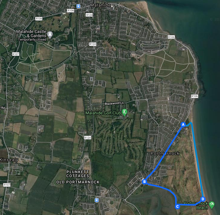
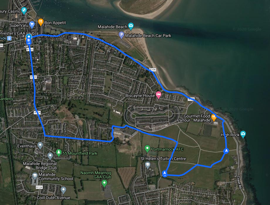
Portmarnock village and Beach is the fifth in our series of looped walks mapped by Stephen Macdonagh. See all Malahide Looped Walks.
You may do the “short walk” as mapped above starting in Portmarnock, or the longer version from Malahide village along the coast walk and back (This can be crowded at weekends and busy times). Another option is to bike along the coast from Malahide to the start of the walk in Portmarnock.
Best walked from C-B-A-D. Finish by walking the beach back to D. Your target is the lower beach lifeguard hut (or the concrete base on which it is placed during the season). The path back to the car park is beside it. Alternatively begin at C and walk in either direction.
If travelling by car, our readers have advised us of an ongoing problem of thefts and break ins to cars parked in the car park at location C, as there is no cctv in the area (as of Dec 2020). Their advice is to start at point “A”.
This walk is not suitable for wheelchairs as much of it is along the beach.
Length: 3.6 km (short walk) From Malahide village along coast and back: approx 14Km.
Surface: Mix of paved and beach (sand)
Footwear: Walking shoes / runners that you’re happy to use on a beach
Calling all volunteers!
Malahide Tidy Towns have organised a tidy up of the green space between Seapark Hill and Seamount Road this coming Saturday (28th Nov 2020). They will be ably assisted by Malahide Lions Club members and Gaisce volunteers.
All additional volunteers are welcome. Social distancing will be observed. Volunteers are asked to wear masks. Malahide Tidy Towns will arrange bags, collection etc.
Volunteers should meet at 10.30 at Malahide Train station, or Seamount Road at 11am. Seapark / Biscayne / Moorings etc. volunteers are meeting at the Seapark Hill entrance.
About the Seapark Hill – Seamount Road Green Space
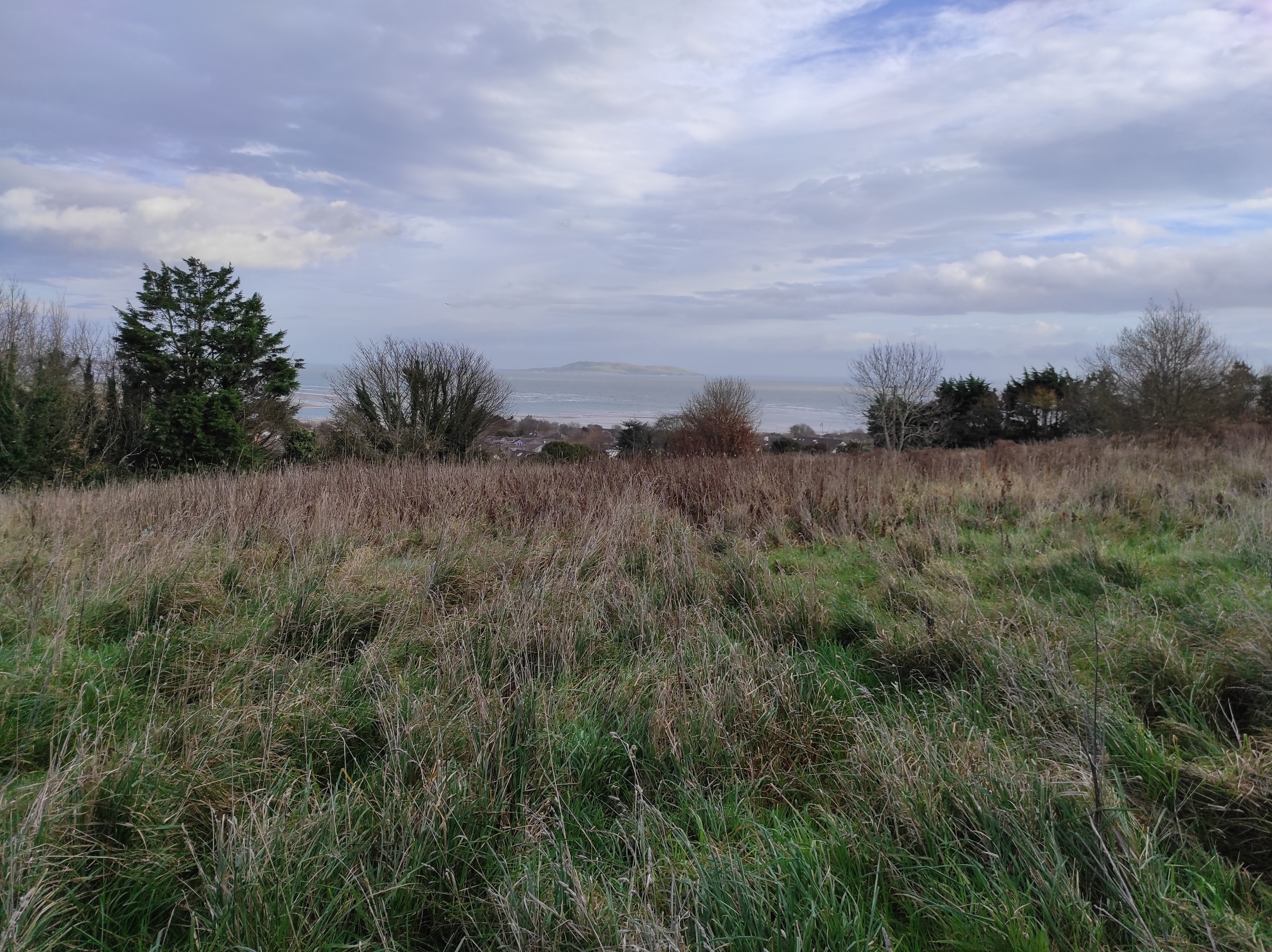
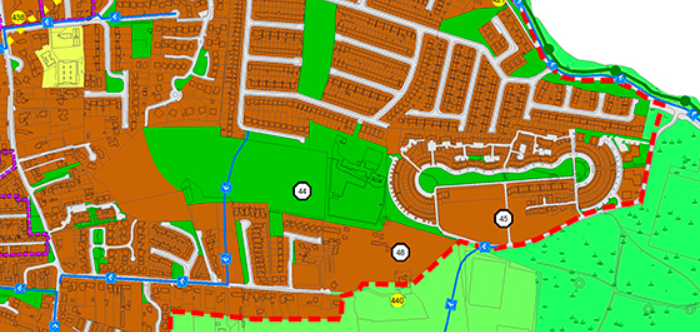
This hidden wilderness, located between Seapark Hill and Seamount Road, has wonderful views over Lambay and into Malahide village itself (You can see the spire of the church). It was formerly the back six/nine holes of the old Malahide Golf course. It is due to become a new park for Malahide. The existing right of way (shown in blue in the image below – green space 44) is used daily by over sixty students of Malahide Community School to walk to/from school.
The Malahide Community Forum is supporting the Seapark and Seamount residents associations in getting Fingal County Council to formalise and upgrade the existing right of way (it is currently a mud path through a field).
Update June 2021: Please be aware that two of the 9 mapped walks are now closed (4 & 6).
Update Jan 2021: We’re all shell-shocked at the rise in Covid-19 cases. We must all do our best to “stay at home” – but we must also stay active. One tip for making social distancing easier is to ‘Wear wellies and take to the mud’!!! Where possible, leave the paved paths for those who need them most. A number of the looped walks below are very muddy at this time of year. While Malahide Castle (walk 2 below) has lots of paved walks – it’s full of muddy trails where you can splash to your heart’s content – go on, you know you’ll love it.
End of Update Jan 2021:
We all know that staying active is critical to our physical and mental health, especially during this challenging time.
To help residents to stay active, we’re publishing a series of “Malahide Looped Walks”, kindly mapped by local resident Stephen Macdonagh. Remember, as these are looped walks, you can start at any point in Malahide and join the walk at your nearest access point. (We’ve also started a series of Malahide Family Friendly bike rides).
For a longer walk, simply combine walk 2 (a walk in the Castle) with any of the other walks. Please remember to share our paths roads and parks with care.
1. Seamount and Paddy’s Hill – 6km – Paved paths
2. Malahide Castle Perimeter – 4km – Mix of paved and crushed ash path
3. Back Strand, Sea Road and Yellow Walls – 3km – Paved paths
4. Abington, Streamstown and Castle – 3km – Some mud paths (very muddy in winter)
[Sadly, this walk was closed in June 2021]
5. Portmarnock village and beach – 3.6km / 14km – Mix of beach and paved paths
6. Seapark Hill to Seamount Road – Variation of walk 1: Steep, muddy
[FCC has temporarily closed this walk to facilitate the provision of a new park – it is expected to re-open in September 2021]
7. Malahide Fairy Forts Trail – Not Looped – Approx 4km end to end – paved paths
8. Back Estuary, Seabury and Swords Road – 7.8km – Paved paths (some steps)
9. Malahide Beach – 4km – Mix of paved paths, beach and grassy paths
About Stephen Macdonagh:
When asked to join the committee of St Sylvester’s GAA Healthy Club section in 2018 local retired teacher Stephen MacDonagh decided that the best way to contribute would be to form a local walking group to explore looped walks in the area. A group of about twenty walkers set out once a month, with the aim of encouraging people in the locality to get out and walk on a regular basis. Week after week more walkers tagged along and it wasn’t unusual to hear the comment “I’ve lived here for twenty years and I’ve never been down this way before!”
When Covid 19 struck earlier this year, social distancing guidelines meant that walking in groups was no longer practical so Stephen decided to map his favourite walks to enable walkers to get exercise locally and enjoy and explore the wonderful walks we have in our locality.

Update June 2021:
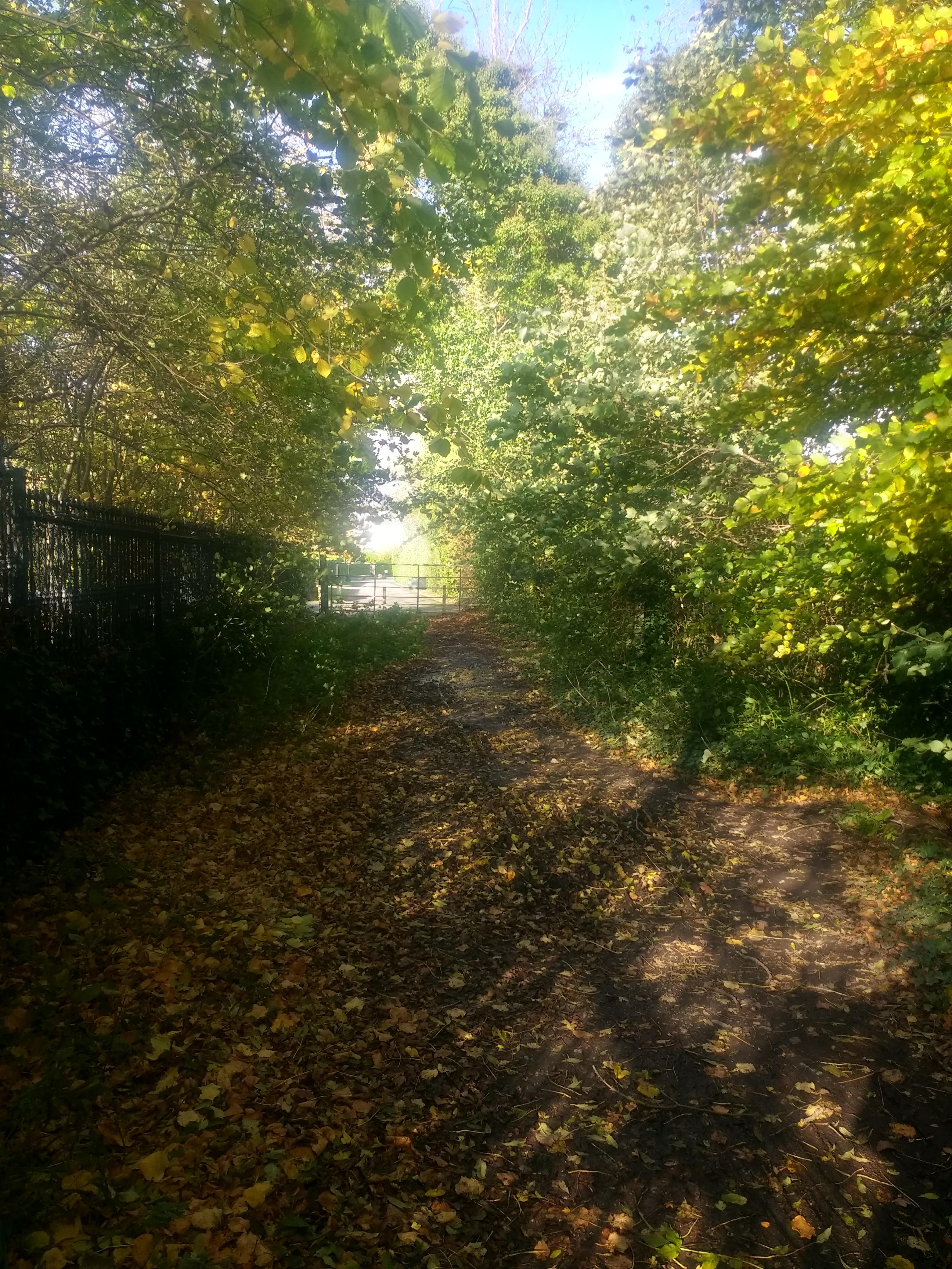
We’re sorry to say that this walk is now closed, as a code controlled pedestrian gate has been added at the Abington end of the woodland path to Streamstown (between C and D on the map above). This walk proved popular during the pandemic and we hope that the residents of Abington will reconsider their decision and remove the gate to provide access for all walkers.
End of Update.
The fourth in our series of looped walks mapped by Stephen Macdonagh. See all Malahide Looped Walks.
Begin at Malahide Castle (Swords Rd. gate). Walk along Swords Road to Castle Heath and turn left. Entering Abington keep straight and follow road to end and through gate. Between C and D on the map there is a woodland path (can be muddy). Cross the road at Auburn (carefully!) and enter Malahide Castle.
For a longer walk, combine this route with a walk in the Castle and some or all of the Seamount and Paddy’s Hill walk . Please remember to share our paths roads and parks with care.
While this walk is wheelchair accessible, the path from Abington to Streamstown (C to D on map) can be very muddy.
Length: 3 km
Surface: Mix of paved and mud path (can be very muddy).
Footwear: Hiking boots / wellies recommended as path C to D can be very muddy.
Here are the notes for October 2020.
The notes of our previous meetings are available on our monthly notes page.
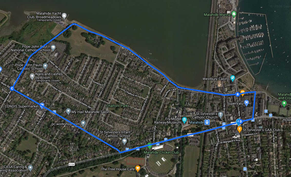
The third in our series of looped walks mapped by Stephen Macdonagh. See all Malahide Looped Walks.
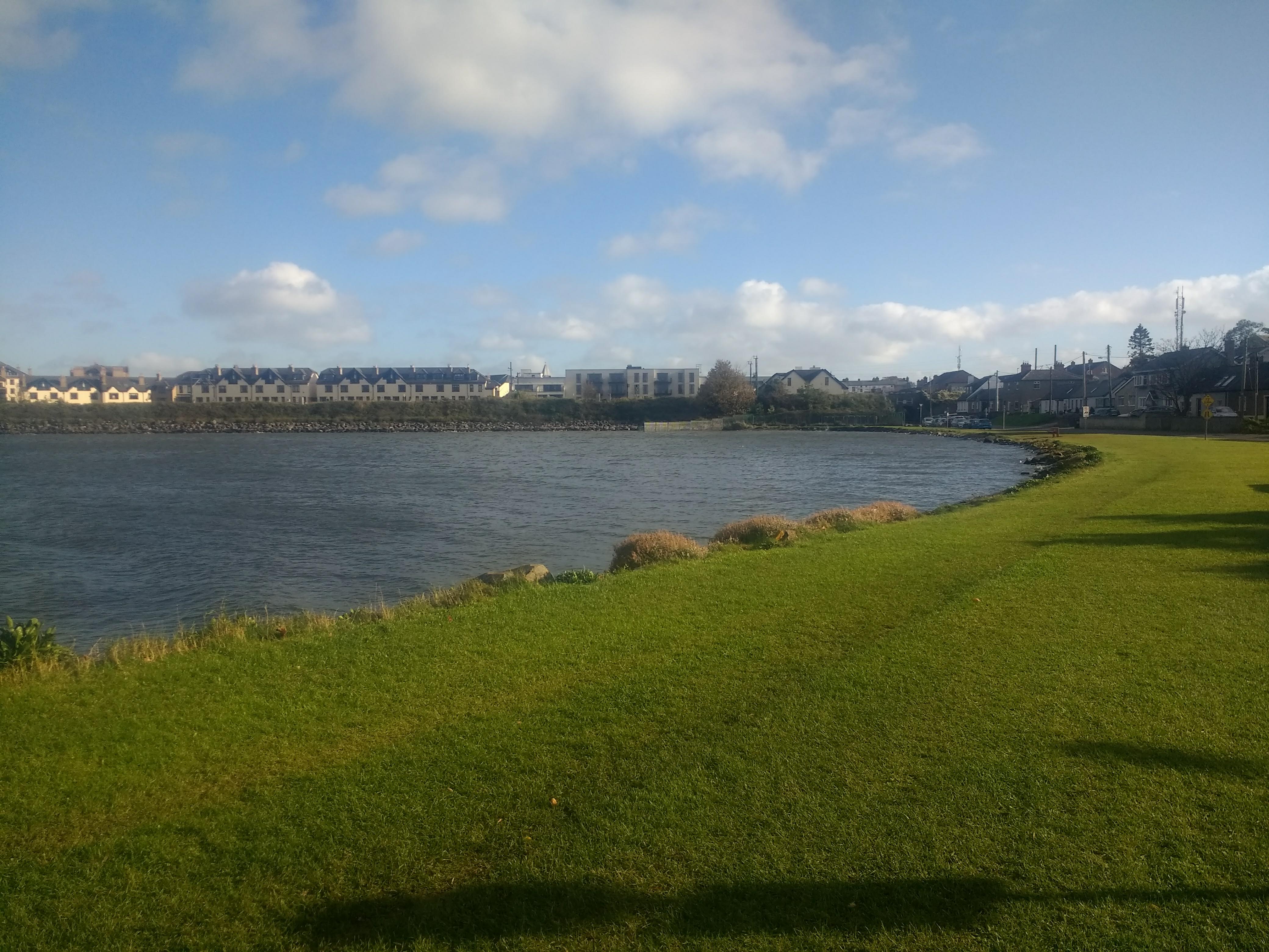
This 3km walk takes you from the village centre (Townyard Lane) along the inner Broadmeadow Estuary, up Sea Road to the junction with Yellow Walls Road. It turns left, along Yellow Walls Road towards the Dublin Road and Malahide Demesne. Follow the Dublin Road back into the village.
For a longer walk, combine this route with a walk in the Castle and some or all of the Seamount and Paddy’s Hill walk . Please remember to share our paths roads and parks with care.
This walk is wheelchair accessible.
Length: 3 km
Surface: Fully paved
Footwear: Walking shoes / runners (no need for hiking boots)


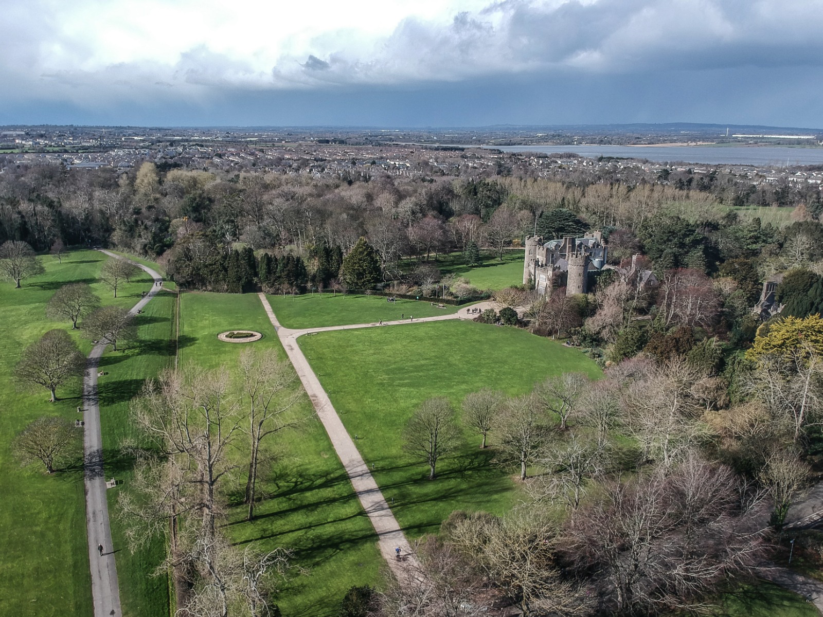
This is the second in our series of looped walks mapped by Stephen Macdonagh. See all Malahide Looped Walks.
Malahide Castle perimeter walk is just over 4k but there are many permutations and combinations in this wonderful facility. This walk takes you through beautiful woods – with great views of the castle.
You can easily combine a walk in the Castle with some or all of the Seamount and Paddy’s Hill walk . Please remember to share our paths roads and parks with care.
This walk is wheelchair accessible.
Length: 4 km
Surface: Mix of paved and crushed ash paths (good drainage after rain)
Footwear: Walking shoes / runners (no need for hiking boots)
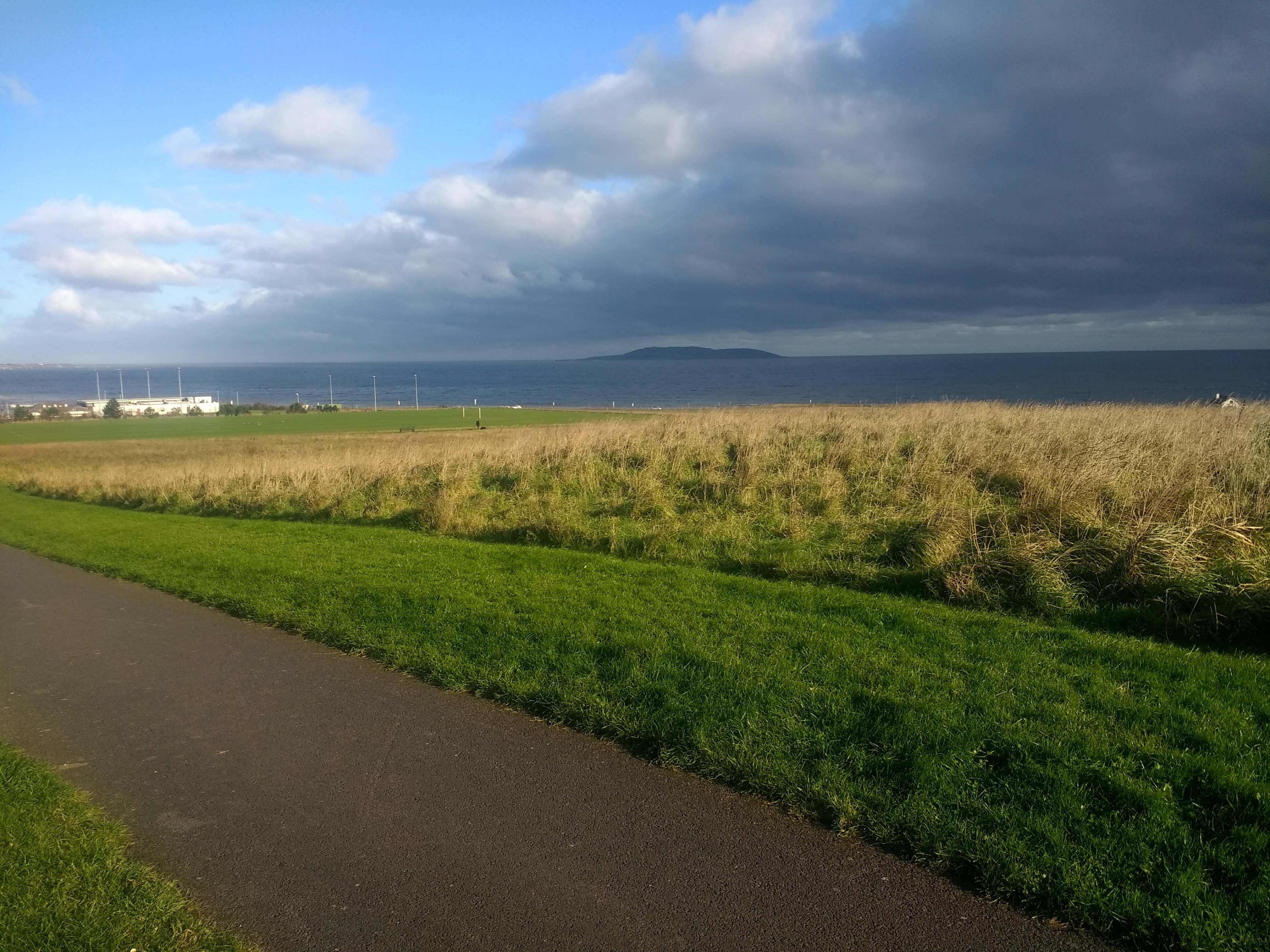
We all need to ensure we take exercise during this challenging time. This 6km walk is the first in a series of looped walks mapped by Stephen Macdonagh. See all Malahide Looped Walks.
The views from Robswall park, of Lambay and Irelands Eye are stunning. They change with the seasons, the light and the weather. This walk is wheelchair accessible, but does have some steep sections. If you bike this route – please remember that all paths in Fingal parks are “share with care” – pedestrians have priority.
Length: 6 km
Surface: Paved paths
Footwear: Walking shoes / runners (no need for hiking boots)
Here are the notes for September 2020.
The notes of our previous meetings are available on our monthly notes page.
